Lighthouse · Cape Flattery, Washington
Cape Flattery Lighthouse
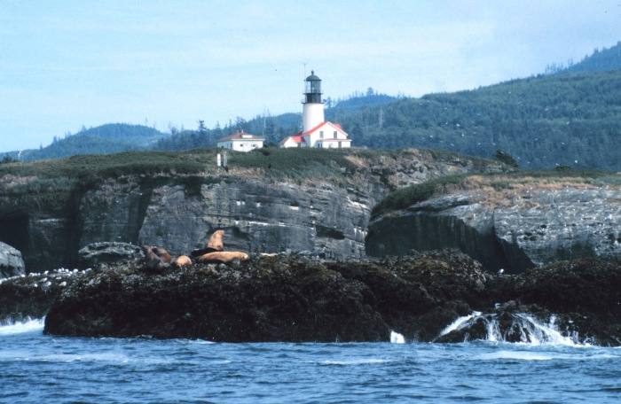
The tower, first lit in 1857, is dark now. The working light, two white flashes every 20 seconds, stands nearby, about 50 m away. The lighthouse stands on Tatoosh Island off the northwest tip of the contiguous United States, on Makah land closed to visitors.
Open in the viewer from Cape Flattery trail overlook →
Quick facts
| Type | Lighthouse |
|---|---|
| Built | 1857 |
| Light | Fl (2)W 20s |
| Position | 48.3916°N, 124.7367°W |
| From Cape Flattery trail overlook | 1.8 km (1.1 mi), bearing 300° WNW |
| Source | OpenStreetMap; NOAA ENC US5WA2YA (the working light); USCG Light List Vol. VI |
How to see it
Above water and inside the horizon from Cape Flattery trail overlook, 1.8 km (1.1 mi) away, so on a clear day it can be seen from there, and CoastFinder puts a label on it.
On the website for now. Washington's lighthouses are in the web viewer first, and they are coming to the CoastFinder app, which covers the North Carolina coast today. Follow @coastfinderapp to hear when Washington arrives.
Nearby
- Destruction Island LighthouseLighthouse · 82 km
- Turn Point LighthouseLighthouse · 115 km
- Lime Kiln LighthouseLighthouse · 118 km
- New Dungeness LighthouseLighthouse · 123 km
- Cattle Point LighthouseLighthouse · 131 km
- Patos Island LighthouseLighthouse · 137 km
Not for navigation. Positions and depths come from public charts and records, with their sources named above; they are for looking, not for piloting a boat.