CoastFinder App
Point your phone at the water and CoastFinder names what you are looking at.
Stand on a beach, a dock, a pier, a boat or a headland. CoastFinder draws a labelled panorama over the live camera view: every island, lighthouse, shipwreck, shoal and reef in front of you, each with its name, its distance and its depth. It is for iPhone, it is bought once, and it works with no signal.

Features
 Point and name
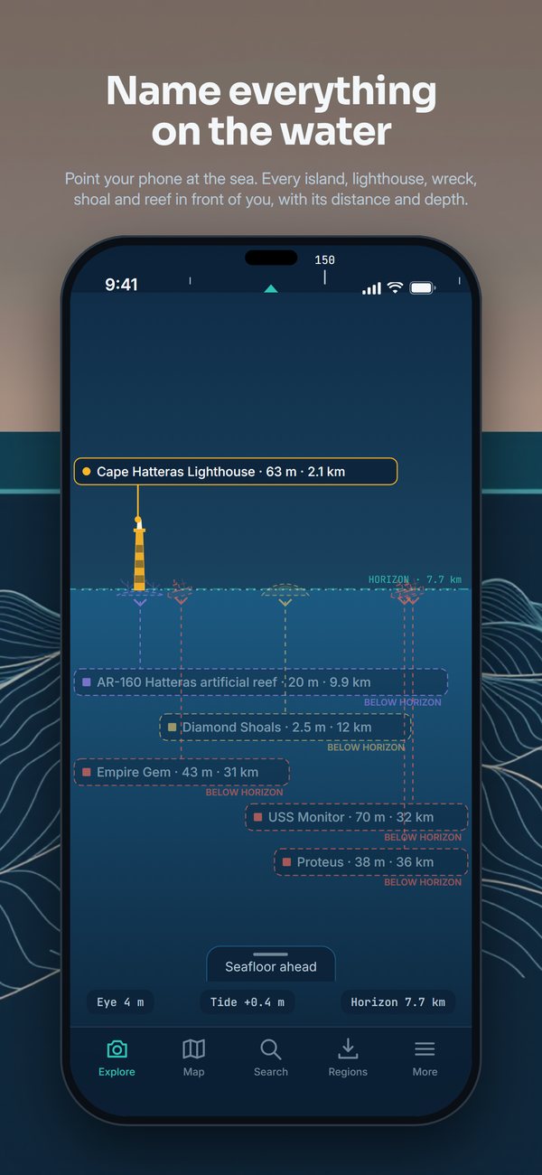
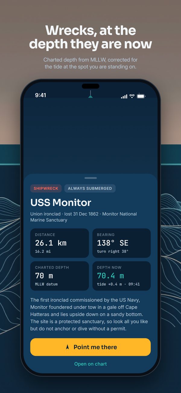
Hold up your phone and every island, lighthouse, shipwreck, shoal and reef in front of you is labelled with its name, its distance and its height or depth. Lighthouses are drawn as outlines on the view. Tap any label for a detail card with bearing, distance and a short description.
Nothing is recognised in the picture. The app knows where you are, which way you are pointing, and where every charted feature sits. The rest is arithmetic.
 Below the waterline
A wreck, reef or shoal has no silhouette. Its label sits on the water directly above the site and is styled so you know at a glance that it is submerged.
Every submerged feature carries its charted least depth from MLLW, an estimate of the depth right now from the nearest tide station, and a note when it is awash or exposed at low water.
Below the horizon
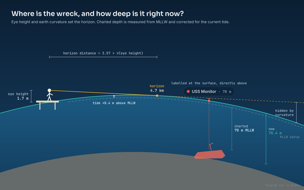
From a beach, the curve of the earth hides almost everything worth naming: at Cape Hatteras, one notable feature in thirty-three is genuinely in sight from eye height. CoastFinder does not quietly delete the rest.
Hidden features are drawn faintly and marked below the horizon, with a true bearing and distance, so you know what is out there and which way it lies. Raise the eye-height slider on the camera screen and watch them rise into view.
Seafloor ahead
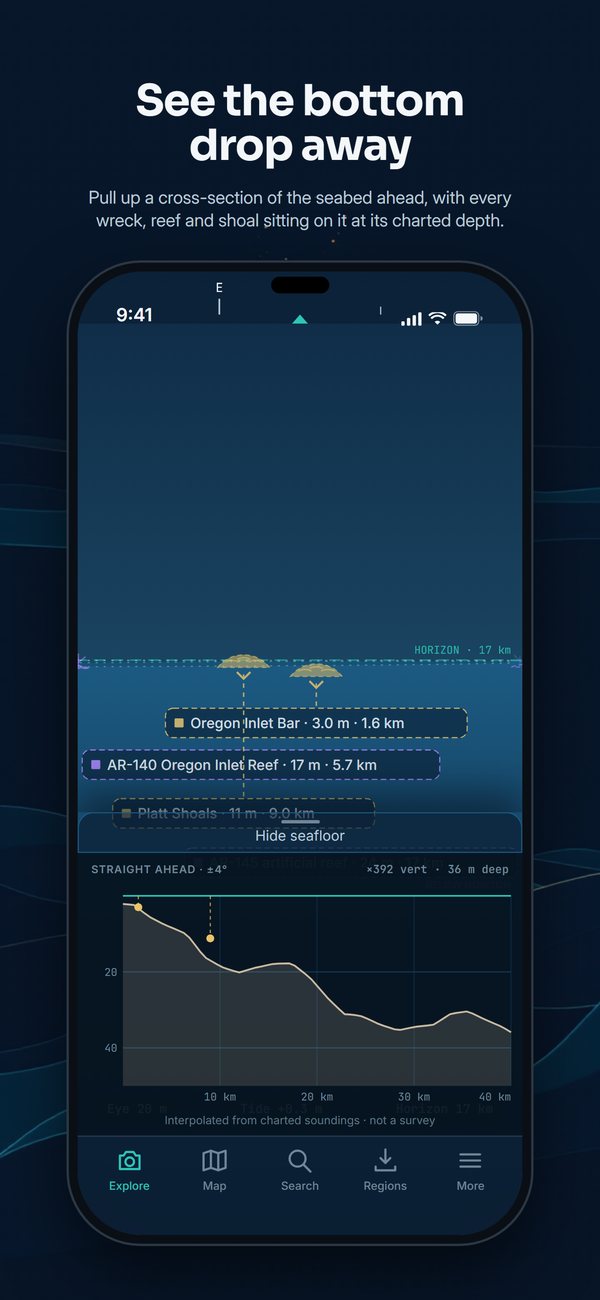
Depth contours run out across the water and darken it with distance. Pull up the cross-section and the bottom gets an axis of its own: the shelf falling away ahead of you, with every wreck, reef and shoal sitting on it at its charted depth.
The profile is interpolated from charted soundings, not surveyed, and the panel says so.
Drag to align
A phone compass wanders. Tap Drag to align in the toolbar, then drag sideways until a lighthouse sits under its label, and up or down until the dashed line sits on the real horizon. Every label moves together. Reset clears it and Done puts it away.
The Steady heading switch blends the gyroscope with the compass, so labels follow a pan without lag and hold still when you do.
Detail levels
Four levels decide how much of the chart gets a label. Notable is the default: every lighthouse, and the wrecks worth the walk, the ones visible from shore, on a dive list, in Wikipedia or on the National Register. Named, Named + visible and Everything add more, up to every symbol on the chart.
Search and point me
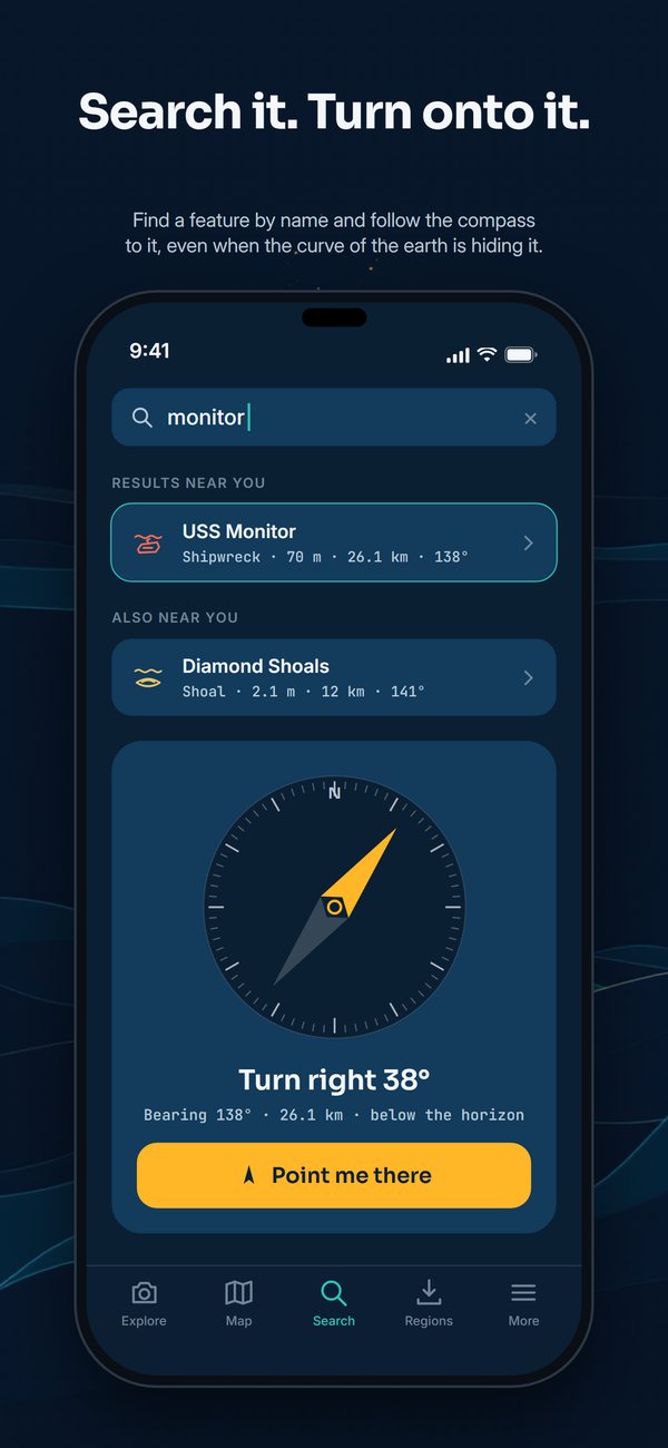
Find a feature by name, then follow the compass arrow until you are facing it, even when the curve of the earth is hiding it.
 Map
Map
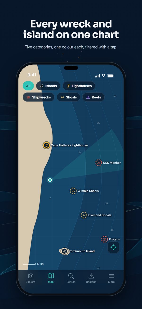
A dark chart with all five categories, islands, lighthouses, shipwrecks, shoals and reefs, one colour each and filtered with a tap.
Report a problem, with a sighting
Every detail card ends with Something wrong with this? Report it. Say what is wrong: the place, the name, the depth or height, or that it is not there. For a misplaced feature, take a sighting by aiming the centre of the screen at the real thing.
The report opens as a draft email to support@coastfinder.app in your own Mail app, with your position included. Nothing leaves the phone unless you press Send.
Offline regions
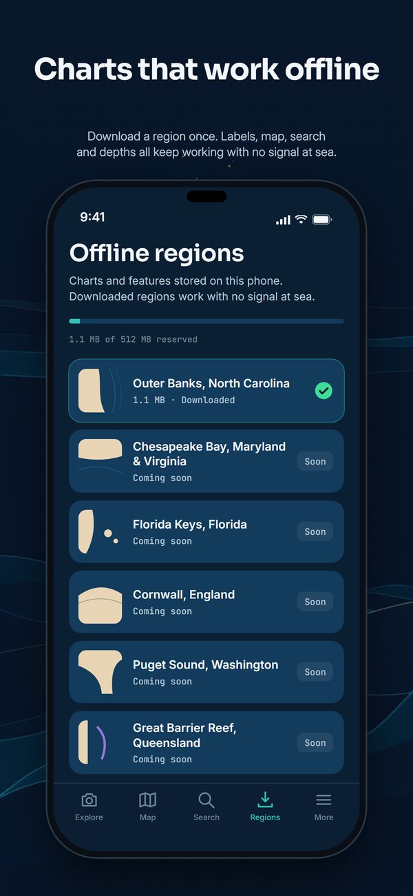
Signal is worst exactly where this app is most useful. A region is a compact pack of coastline, features, tide predictions and a depth grid, and the overlay, map, search and detail cards all work with the radio off.
Two regions are included: the Outer Banks, with 723 features, and the Grand Strand and Cape Fear, with 306.
Manual location
Stand somewhere else and look. Pick a preview spot, such as the Ocracoke ferry dock or Bodie Island Lighthouse, or enter coordinates, then drag to look around. It is a good way to see what is out there before you go.
Send to your chartplotter
Send any feature to your chartplotter, handheld or dive computer as a GPX waypoint, or copy its coordinates. Submerged sites carry their charted depth, and the file repeats the datum, the source and the warning: these are reference positions, not navigational ones.
Bought once
CoastFinder is a single purchase of $4.99. There is no account, no subscription and no advertising. Your position is used on the phone to work out what is in front of you. Every detail card names its source, and the Data sources list in the app credits each one.
CoastFinder is for looking at the water, not for navigating on it.
Want to try it first? The web version runs the same engine in your browser.