Lighthouse · Cape Fear, North Carolina
Price's Creek Lighthouse
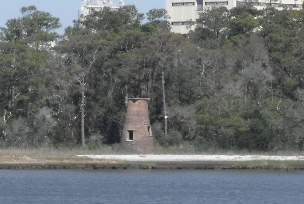
A small brick tower from 1849, about 20 ft (6 m) tall, one of a chain of range lights that once guided ships up the Cape Fear River to Wilmington, and the only one of them still standing. During the Civil War Confederate signalmen used it to talk blockade runners through the river's defences. It sits on private industrial land on the river's west bank and cannot be visited, but it is plainly seen from the Southport to Fort Fisher ferry.
Open in the viewer from Oak Island Lighthouse →
Quick facts
| Type | Lighthouse |
|---|---|
| Built | 1849 |
| Position | 33.9361°N, 77.9897°W |
| From Oak Island Lighthouse | 6.4 km (4.0 mi), bearing 43° NE |
| Source | OpenStreetMap; Curated (SC DNR / NC DMF / dive references) |
How to see it
Above water and inside the horizon from Oak Island Lighthouse, 6.4 km (4.0 mi) away, so on a clear day it can be seen from there, and CoastFinder puts a label on it.
Point your phone at the real thing. The CoastFinder app draws this lighthouse over your live camera view from any beach, pier or boat near Cape Fear, with its distance and height, and it works with no signal.
Nearby
- Horseshoe ShoalShoal · 0.1 m · 3.6 km
- Oak Island LighthouseLighthouse · 47 m · 6.4 km
- Sheephead RockReef · 2.7 m · 7.0 km
- Bald Head LighthouseLighthouse · 7.0 km
- Western Bar ChannelShoal · 1.5 m · 7.2 km
- Jay Bird ShoalsShoal · 0.1 m · 7.4 km
Not for navigation. Positions and depths come from public charts and records, with their sources named above; they are for looking, not for piloting a boat.