Island · Wrightsville Beach, North Carolina
Figure Eight Island
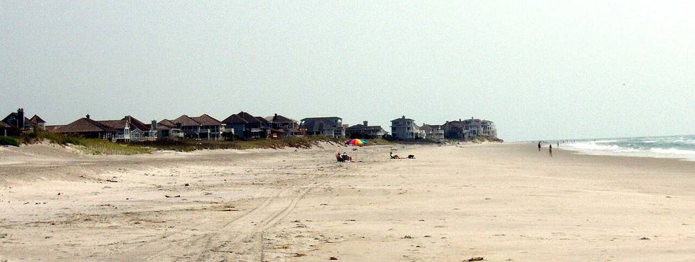
A private barrier island just north of Wrightsville Beach, reached only by a guarded bridge. Developed from the 1960s as a quiet enclave of large houses with no shops, hotels or public access, it is best seen from the water or from the north end of Wrightsville Beach across Mason Inlet.
Open in the viewer from Johnnie Mercer's Pier, Wrightsville Beach →
Quick facts
| Type | Island |
|---|---|
| Position | 34.2701°N, 77.7422°W |
| From Johnnie Mercer's Pier, Wrightsville Beach | 7.5 km (4.7 mi), bearing 33° NNE |
| Source | OpenStreetMap; Curated (SC DNR / NC DMF / dive references) |
How to see it
Above water and inside the horizon from Johnnie Mercer's Pier, Wrightsville Beach, 7.5 km (4.7 mi) away, so on a clear day it can be seen from there, and CoastFinder puts a label on it.
Further reading: Figure Eight Island on Wikipedia.
Point your phone at the real thing. The CoastFinder app draws this island over your live camera view from any beach, pier or boat near Wrightsville Beach, with its distance and height, and it works with no signal.
Nearby
- Captain TomShipwreck · 12.8 m · 3.6 km
- Captain JerryShipwreck · 12.8 m · 3.6 km
- HT-290Shipwreck · 12.8 m · 3.6 km
- Billy Murrell Reef (AR-364)Reef · 6 m · 3.6 km
- LCM 6Shipwreck · 12.8 m · 3.7 km
- Johnnie Mercer's PierPier · 7.5 km
Not for navigation. Positions and depths come from public charts and records, with their sources named above; they are for looking, not for piloting a boat.