Island · Crystal Coast, North Carolina
Bogue Banks
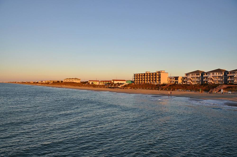
A 21-mile barrier island running east to west, which is why its beaches face south and the sun sets over the water. Atlantic Beach, Pine Knoll Shores, Indian Beach and Emerald Isle sit along it; Fort Macon, finished in 1834 to guard Beaufort Inlet, holds the eastern tip, and the Crystal Coast's wrecks and reefs lie offshore.
Open in the viewer from Bogue Inlet Pier, Emerald Isle →
Quick facts
| Type | Island |
|---|---|
| Position | 34.6834°N, 76.9014°W |
| From Bogue Inlet Pier, Emerald Isle | 14 km (8.8 mi), bearing 76° ENE |
| Source | OpenStreetMap; Curated (NOAA AWOIS / NC DMF / NPS) |
How to see it
Above water and inside the horizon from Bogue Inlet Pier, Emerald Isle, 14 km (8.8 mi) away, so on a clear day it can be seen from there, and CoastFinder puts a label on it.
Further reading: Bogue Banks on Wikipedia.
Point your phone at the real thing. The CoastFinder app draws this island over your live camera view from any beach, pier or boat near Crystal Coast, with its distance and height, and it works with no signal.
Nearby
- Ft. FisherShipwreck · 14.9 m · 9.0 km
- NoveltyShipwreck · 14.9 m · 9.0 km
- Clifton Moss Reef (AR-320)Reef · 14.9 m · 9.1 km
- AR-380 artificial reefReef · 1.5 m · 9.9 km
- Bogue Inlet PierPier · 12 km
- Drum ShoalsShoal · 0.9 m · 13 km
Not for navigation. Positions and depths come from public charts and records, with their sources named above; they are for looking, not for piloting a boat.